Episode 8
Due Diligence and the Axe

July, 1988
N 48°05′35.08” - W 123°43′14.80″
Lakes Crescent and Sutherland lie a dozen or so miles west of Port Angeles. The S’Klallam people and the geologists tell us that the two lakes, once a single body of water, were separated by a colossal landslide caused by a massive earthquake over three centuries ago—the legendary Big One. The ground between the lakes is convoluted and huge boulders can be seen scattered about. In July of 1988, Jeff and I were making one final visit to the East 1/4 corner of Section 17, which lies just north of Lake Sutherland. The broken terrain along east line of the section rises gradually at first. But at a point just south of the 1/4 corner, the ground rises abruptly gaining nearly 1000 feet of elevation in less than half a mile. The crew and I had visited the hillside search area several times already.
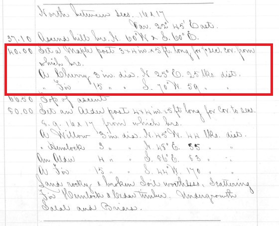
The original corner monument, a 3” x 4” maple post, had been set on December 11, 1879 by U.S. Deputy Surveyor Ross P. Shoecraft, and no one had reported seeing it since. Shoecraft had marked two Bearing Trees (BTs) to preserve the corner’s location: a 3” diameter Bitter Cherry and a 15” diameter Douglas Fir. We had found no trace of Shoecraft’s work during our previous visits. Nor did we expect to find remains of the maple post or the Bitter Cherry after nearly 109 years, as these species are short lived and once dead, decay quickly. Moreover, the hillside had been logged over years before, and only second-growth trees now stood on the hillside. Jeff and I did have an updated search position, based on a “begin ascent” call from the original field notes. But, if we failed to find evidence of the original corner after this visit, I would declare it lost and accept an undocumented monument we had found nearby. This monument had been set at a calculated mid-point position by another local surveying company.
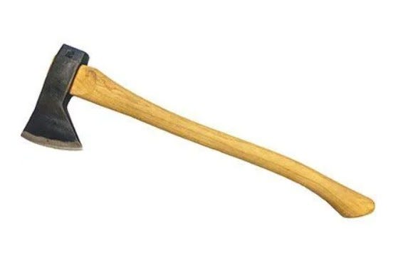
At the updated search position, Jeff and I tore apart every rotten stump we could find, fir or not, with no positive result. Finally, I reached the conclusion that Due Diligence had been served. I gave my Hudson’s Bay axe a toss to punctuate the finality of my decision. It flew, end over end for 15 feet or so, splitting open a rotten piece of fir, about 6 feet long, that was partially buried in the ground. I walked over to retrieve the axe and was astonished to see that its landing had split open the chunk of fir log, exposing perfectly preserved 109-year-old scribe marks. Further investigation revealed that the Fir BT had died, but not before the 1879 scribe marks had been encased and preserved in new wood growth. At some point after that, the tree had died; the remains we had found had broken free of the stump, fell to the ground, and had slid a short distance down the hillside.
We restored the original corner position with a modern monument, based on the record bearing and distance from the BT stump remains. This position was further confirmed by its agreement with the “begin ascent” call from the 1880 field notes. 39 feet away was the undocumented monument I had planned to accept as the corner.
Lessons learned
Land surveys are based upon physical and documentary evidence of the work of surveyors who have gone before us; we strive to “follow in the footsteps” of our forebears. Doing so tends to promote boundary stability. In this case we were making one last attempt to find evidence of an original survey monument set over a century before, which no one had seen since. In the course of our search, we found a modern monument, set at a mathematical position that, while conforming with the field notes of the 1879 survey, was not located where the original surveyor set his corner monument.
Lesson:
Calculated mathematical restorations of General Land Office corners based solely on measurements recorded in the original records will almost certainly NOT be located where the original corner monument was set. This is because the tools and methods used in the original surveys were pretty crude when compared to modern instruments and methods. Nevertheless, it is a long-established principle that original corner locations recovered in the field predominate over measurements recorded in the field notes, or positions based solely upon those measurements. In other words monuments, when occupying their original locations, control over measured values.
Lesson:
You will always find what you are looking for in the last place you look for it.