Episode 15
A Hitchhiker's Guide to Chicken Coop Road

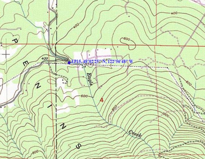
Lat. 48º 02’ 25” N, Lon. 122º 56’ 48” W
Near the Clallam/Jefferson County Line
Chicken Coop Road is a two-lane county road. Once upon a time, a dance hall, reputedly the site of a former chicken ranch, was located in the area. It was still standing the last time I drove by in the mid-2010s. Starting at Blyn near the head of Sequim Bay, the road weaves its way northeasterly through forest, rural residential and farmland in the extreme east end of Clallam County. As the road approaches the Eagle Creek draw it switches back on itself in a hairpin curve as it crosses the creek, briefly wanders into Jefferson County, then back into Clallam County and thence runs north to US 101.
About a quarter-mile from its westerly terminus an unpaved forest road branches off on the right, providing access to state forest lands that lie south of the county road. Leaving Chicken Coop Road, we drove the Travelall on this road system, heading east, until we could go no further. Our mission that day was to visit a corner monument the foresters had found that needed some repair work. We geared up for a 3/4 mile walk through the woods and an old clear-cut to where the corner monument was located. We loaded our vests with all the supplies we’d need: spray paint, aluminum reference tags and nails, flagging, and axes. We strapped machetes on our belts. The walk was difficult as we had to negotiate the clearcut thick with old slash, young fir trees and alders, and the occasional draw. At last, we reached our destination. The monument was located at the edge of the replanted clearcut, near a skid road along its east boundary.
We restored the monument, set new reference points, and now it was time to head back. No one was enthusiastic about retracing our steps back to the truck, because the walk in had been kind of difficult. Bob, our fearless leader, took stock of the situation. Standing on the skid road, he deployed his Silva Ranger compass to determine its general direction of travel. “Let’s follow this skid road,” he said, “it’s kind of headed in the right direction.” It seemed like a good idea at the time. It was an easy downhill walk on the skid road, but it curved gradually and inexorably around to the north. Soon, we were committed. We continued to follow the skid road, and eventually, we found ourselves on Chicken Coop Road, near the Eagle Creek switchback. By now we were 3 miles by road from where we had parked the truck, but no one really wanted to go back the way we had come.
So, we began the march back to the Travelall west along Chicken Coop Road towards Blyn. We’d gone no more than a quarter mile when two sweet, senior citizen ladies in
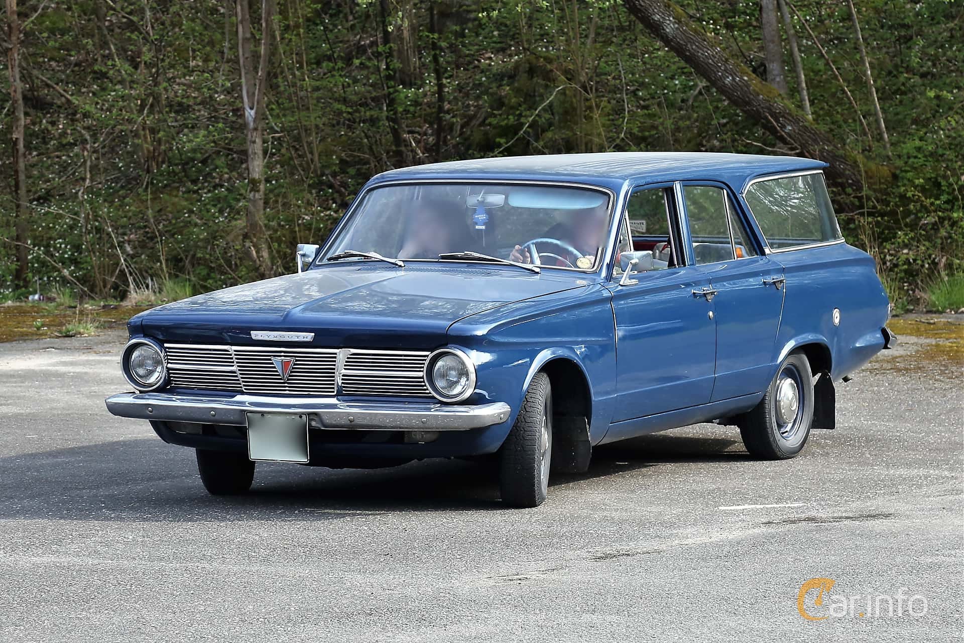
a Plymouth Valiant station wagon pulled up alongside us and stopped. The passenger window came down. “Are you boys lost?,” the passenger asked. Bob related our story, and they offered to give us a lift back to the truck. So, two of us climbed gratefully into the back seat and two into the “way-back” and off we went. Soon enough we were delivered back to the Travelall. We offered them our most sincere thanks as we disembarked the Valiant. I’m not certain that anyone would pick up a band of such desperados these days, armed as we were with axes and machetes, but I sure am glad they did that day back then.
From the “First Tour” at DNR, 1976-1979
Thanks for reading! Subscribe for free to receive new posts to receive new posts about surveying in the woods on the Olympic Peninsula